What Is a Site Plan? What a Permit Site Plan Needs to Show
A site plan is a scaled drawing of your property that shows what exists, what you plan to build and how it fits zoning rules. Here is what a permit site plan includes.

Updated 13 min read

In this guide 14 sections
- What Is a Site Plan for a Building Permit?
- What Does a Permit Site Plan Need to Show?
- Why Is a Site Plan Required for a Building Permit?
- How to Read a Site Plan for a Building Permit
- What Types of Projects Need a Site Plan?
- What Is the Difference Between a Site Plan, Plot Plan, and Survey?
- How to Prepare a Site Plan for a Building Permit
- Common Site Plan Mistakes That Can Delay Permit Review
- Can I Draw My Own Site Plan?
- Do You Need a Site Plan for a Small Project?
- What Does a Professional Site Plan Cost?
- What Does a Completed Permit Site Plan Look Like?
- FAQs About What Is a Site Plan Used For?
- Final Thoughts: Getting Your Site Plan Ready for Permit Review
If you’re wondering what is a site plan and why your building department requires one, I’ll explain everything you need to know. A site plan is one of the most important drawings I recommend preparing before starting a construction project. Whether you’re building a garage, adding a room, installing a swimming pool, or constructing a new home, your local building department may need to see exactly where the proposed work will sit on your property.
I’ve seen how missing property dimensions, unclear setbacks, and incomplete site information can create unnecessary questions during permit review. A properly prepared site plan helps explain the relationship between your property boundaries, existing structures, and proposed improvements before construction begins.
In this guide, I’ll explain what a site plan is, what a permit site plan needs to show, when you need one, and how to prepare a site plan for a building permit. I’ll also cover common mistakes, drawing requirements, and the information you should gather before submitting your plans.
What Is a Site Plan for a Building Permit?
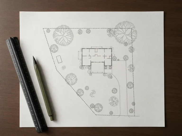
A site plan is a scaled drawing that shows the layout of a property, including its boundaries, existing structures, proposed construction, and important site features. It provides a view of the property from above, allowing building officials to understand how a construction project fits within the available space.
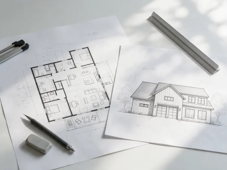
Unlike a floor plan, which focuses on the interior layout of a building, a site plan focuses on the relationship between buildings and the surrounding land. It helps identify property line distances, required setbacks, access routes, and other conditions that may affect permit approval.
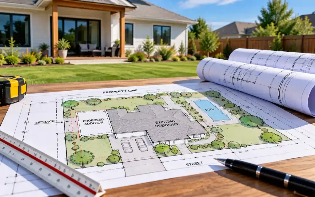
When I prepare a site plan for a building permit, my goal is to make the proposed construction clear enough for the reviewing authority to evaluate its location and relationship to applicable zoning and site requirements. For homeowners who need professional drawings, I recommend starting with our site plan drafting services to understand how a project-specific drawing can support the permit application.
What Does a Permit Site Plan Need to Show?
A permit site plan must provide enough information for the local building department to review the proposed work. Exact requirements vary depending on the jurisdiction, project type, zoning district, and site conditions. However, I generally recommend checking that the following information is included when applicable:
- Property boundaries and lot dimensions: The shape, size, and measurements of the property.
- Existing buildings and structures: The location of the house, garage, sheds, and other permanent improvements.
- Proposed construction: The footprint, dimensions, and placement of new buildings, additions, or structures.
- Building setbacks: Distances between existing or proposed structures and property lines.
- Driveways and access areas: Vehicle access, parking spaces, walkways, and relevant entrances.
- Easements and restrictions: Recorded utility easements, drainage easements, and other known limitations affecting construction.
- Utilities and drainage features: Relevant sewer, septic, water, drainage, and utility information when required.
- Drawing information: A north arrow, scale, labels, dimensions, and other details needed to interpret the plan.
I don’t assume that every project needs every item. A simple backyard shed may require fewer details than a new home or commercial development. The important thing is to match the drawing to the building department’s actual submission requirements.
Why Is a Site Plan Required for a Building Permit?
Building departments use site plans to understand how proposed construction relates to the property and surrounding conditions. Before issuing a permit, reviewers may need to confirm that a project complies with zoning regulations, setback requirements, lot coverage limits, and other applicable rules.
For example, if you’re planning a detached garage, the reviewing authority may need to know how far the garage sits from the rear and side property lines. Without those measurements, officials may be unable to determine whether the proposed location complies with local requirements.
A site plan can also help identify potential conflicts with easements, existing structures, access routes, or drainage areas. I prefer addressing these concerns during the drawing stage rather than discovering them after construction has started. For projects requiring additional construction documents, our permit drawing services can help homeowners understand the broader drawing package that may be necessary.
How to Read a Site Plan for a Building Permit
A site plan may look complicated at first, especially when it contains dimensions, symbols, labels, and multiple building footprints. However, I find that reading the drawing becomes much easier when you understand how the information is organized.
Property Lines and Lot Dimensions
Property lines identify the legal boundaries of the parcel. They establish where the property begins and ends and provide a reference for measuring setbacks and locating improvements.
I recommend using reliable property records or survey information when preparing these dimensions. Online parcel maps can provide useful reference information, but they may not be accurate enough to establish legal boundaries for construction.
Existing and Proposed Structures
A clear site plan distinguishes existing buildings from proposed improvements. Different line styles, labels, or drawing notes may be used to identify what is already on the property and what will be constructed.
For example, an existing house may be shown with a solid outline, while a proposed addition may be identified using a different line type or label. This distinction helps reviewers understand the scope of work without confusing existing conditions with new construction.
Scale, North Arrow, and Measurements
A site plan should use a consistent drawing scale so that the relationship between property features can be understood accurately. Common scales for residential drawings include 1 inch equals 10 feet or 1 inch equals 20 feet, although the appropriate scale depends on the property and local requirements.
I also include a north arrow and clear dimension labels where needed. These details help reviewers interpret the drawing and verify the proposed placement of structures.
What Types of Projects Need a Site Plan?
Not every construction project requires the same drawings. However, site plans are commonly requested when work changes the location, footprint, or use of structures on a property.
Home Additions and Residential Construction
When homeowners expand their living space, the building department may need to review the new building footprint and its distance from property boundaries. A site plan can show whether the addition affects setbacks, lot coverage, access, or other site conditions.
For these projects, I recommend reviewing our home addition plans to understand the types of drawings that may be needed alongside the site plan.
Garages, ADUs, and Accessory Structures
Detached garages and accessory dwelling units often require careful attention to placement, building separation, setbacks, and utility connections. Even when a structure fits comfortably within the backyard, zoning restrictions may limit where it can be built.
I always recommend checking these conditions before finalizing the proposed location. Our ADU permit plans provide a relevant starting point for homeowners planning an accessory dwelling unit.
Decks, Patios, Pools, and Outdoor Improvements
Outdoor projects may also require site plans, particularly when they involve permanent construction near property lines or easements. Decks, covered patios, pools, and similar improvements can affect setbacks, drainage, or lot coverage.
For swimming pool projects, I recommend reviewing our pool site plans because pool placement may involve additional site-specific requirements, including equipment locations, barriers, and separation distances.
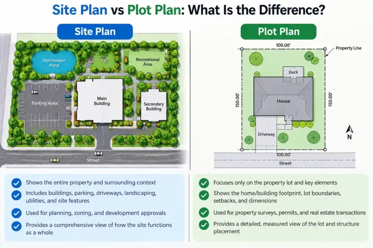
What Is the Difference Between a Site Plan, Plot Plan, and Survey?
I often hear homeowners use the terms site plan, plot plan, and property survey interchangeably. Although these documents can contain similar information, they do not always serve the same purpose.

A site plan generally shows existing property conditions and proposed development or construction. It is commonly prepared for permit applications and planning reviews. A plot plan may serve a similar purpose, especially for smaller residential projects. Some jurisdictions use the terms almost interchangeably, while others have specific requirements for each document. A property survey is prepared by a licensed surveyor and can establish property boundaries and other surveyed features. A drafted site plan does not automatically replace a legal boundary survey.
I recommend confirming which document your building department requires before ordering drawings. When a project involves uncertain boundaries, tight setbacks, or disputed property lines, a professional survey may be necessary.
How to Prepare a Site Plan for a Building Permit
Preparing a site plan starts with gathering accurate information about the property and understanding what the proposed project will change. I generally approach the preparation process in the following order:
- Review local permit requirements. Identify the building department’s site plan checklist, required drawing scale, and applicable zoning information.
- Collect property documents. Gather available surveys, recorded plats, property records, and previous approved drawings.
- Document existing conditions. Identify buildings, driveways, walkways, utilities, and other relevant features.
- Define the proposed project. Confirm the new structure’s footprint, dimensions, location, and intended use.
- Prepare and review the drawing. Add required measurements, labels, setbacks, and site information before submission.
- Check the final permit package. Confirm that the site plan is consistent with other submitted drawings and the reviewing authority’s requirements.
I also recommend checking the property information carefully before drafting begins. Incorrect dimensions or an outdated building footprint can create inconsistencies that become difficult to resolve during permit review. If you’re unsure how the drawing process works, our how it works page provides an overview of getting started with a drawing request.
Common Site Plan Mistakes That Can Delay Permit Review
One of the most avoidable problems in permit preparation is submitting a drawing that does not clearly communicate the proposed work. Even when a project is otherwise acceptable, incomplete information may result in correction requests. I recommend reviewing the following common issues before submitting a permit site plan:
- Missing or incorrect setbacks: The drawing does not clearly show the distances between structures and property boundaries.
- Unclear proposed construction: Existing and proposed improvements are not properly identified or dimensioned.
- Inconsistent property information: Lot dimensions, building footprints, or other measurements do not match the supporting documents.
- Missing site features: Relevant easements, driveways, utilities, or drainage information is omitted.
- Incorrect drawing scale: The plan cannot be interpreted reliably at the scale provided.
- Incomplete submission requirements: The building department requests additional information or drawings that were not included.
When a building department issues comments, I recommend addressing each correction carefully rather than making isolated changes without reviewing the entire drawing package.
For projects that have already received review comments, our permit correction services may help with the drawing revisions needed to respond to the reviewing authority.
Can I Draw My Own Site Plan?
In some jurisdictions, homeowners can prepare their own site plans for straightforward residential projects. However, acceptance depends on local rules, project complexity, and whether professional preparation or certification is required.

If you’re drawing your own site plan, I recommend using accurate property information and following the building department’s published requirements. A hand-drawn plan may be acceptable for certain minor projects, while other applications require professionally prepared drawings.
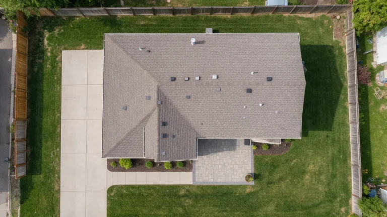
The biggest challenge is often not drawing the property itself. It’s knowing which measurements, site features, and zoning details must be shown. If the property has unusual boundaries, slopes, easements, or complicated existing improvements, professional assistance may be the more practical option. I also caution homeowners against relying on satellite imagery alone. Aerial images can help identify visible features, but they do not reliably establish property boundaries or legal setback distances.
Do You Need a Site Plan for a Small Project?
A small project does not automatically mean that a site plan is unnecessary. Some jurisdictions request site plans for relatively simple structures, including sheds, fences, decks, and patio covers.
The deciding factors may include the structure’s size, height, location, permanence, and proximity to property lines. Zoning approval and building permit requirements may also differ, meaning a project could need a site drawing even when a full building permit is not required.
I recommend checking with the local permitting authority before assuming that a small improvement is exempt. This is especially important when construction will take place near an easement, property boundary, or environmentally regulated area.
What Does a Professional Site Plan Cost?
The cost of preparing a site plan depends on the complexity of the property, the information available, and the level of detail required for permit review. A straightforward residential drawing based on reliable existing property documents may require less work than a site plan involving multiple structures, complex grading, utility coordination, or incomplete property information.
I recommend confirming whether the quoted service includes only drafting or also includes services such as surveying, engineering, revisions, or permit submission. These are different scopes of work and should not be assumed to be included.
Before ordering, homeowners can review our site plan pricing information to explore the available options and determine what may suit their project.
What Does a Completed Permit Site Plan Look Like?
A completed permit site plan should clearly communicate the property’s existing layout and the proposed construction. Reviewers should be able to identify the project location, understand the dimensions, and evaluate the relevant site conditions without having to guess what the drawing represents.
I find real project examples particularly helpful because they demonstrate how different site conditions influence drawing requirements. A residential addition, utility improvement, or accessory structure may each require a different level of information.
For a practical example, you can explore our residential site plan revision project in Grass Valley, California. It provides a project-specific reference for understanding how site plan revisions fit into the permit drawing process.
FAQs About What Is a Site Plan Used For?
Is a Site Plan Required for Every Building Permit?
No. Site plan requirements depend on the type of work and local permitting regulations. Projects involving new construction, additions, or changes to the building footprint commonly require one, while some interior-only improvements may not.
Can I Use Google Maps to Make a Site Plan?
Google Maps or other aerial imagery can provide useful visual references, but I would not rely on them alone for accurate property boundaries, setbacks, or construction dimensions. Additional verified property information may be required.
Does a Site Plan Need to Be Drawn to Scale?
Most permit site plans must be drawn to an accepted scale so reviewers can understand the property’s dimensions and the location of proposed improvements. I recommend checking the required scale with your building department before preparing the drawing.
Is a Site Plan the Same as a Floor Plan?
No. A site plan shows the layout of the property and the location of structures, while a floor plan shows the interior arrangement of rooms, walls, doors, and other building features. Many construction projects require both.
Do I Need a Survey Before Getting a Site Plan?
Not always. Some site plans can be prepared using reliable existing property information. However, I recommend obtaining a survey when property boundaries are uncertain, precise measurements are required, or the reviewing authority specifically requests one.
How Long Does It Take to Get a Site Plan Approved?
Approval time varies by jurisdiction, project complexity, application completeness, and the building department’s workload. A complete site plan can reduce avoidable clarification requests, but it does not guarantee approval within a specific timeframe.
Final Thoughts: Getting Your Site Plan Ready for Permit Review
Now that you understand what is a site plan and what it needs to show, you can prepare your permit application with greater confidence. A site plan is more than a drawing of your property. It is an important part of communicating where construction will take place and how the proposed improvements relate to property boundaries, existing structures, and applicable site requirements.
I recommend treating site plan preparation as an early step in the permit process rather than waiting until the building department requests corrections. Accurate property information, clearly identified construction, and complete dimensions can make the application easier to review.
At Make a Site Plan, we help property owners prepare drawings for a range of residential and commercial projects. If you’re planning construction and need to understand the site plan requirements for your property, contact our team to discuss your project and the drawings you may need.
Need drawings for your project?
Send the address and what you plan to build. We check your jurisdiction and reply with a scope and price.