Site Plans LLC d/b/a Make A Site PlanPermit drawings for all 50 states
Skip to content

SITE GRADING & SURFACE WATER

Grading & Drainage Plans for Site Development & Permits

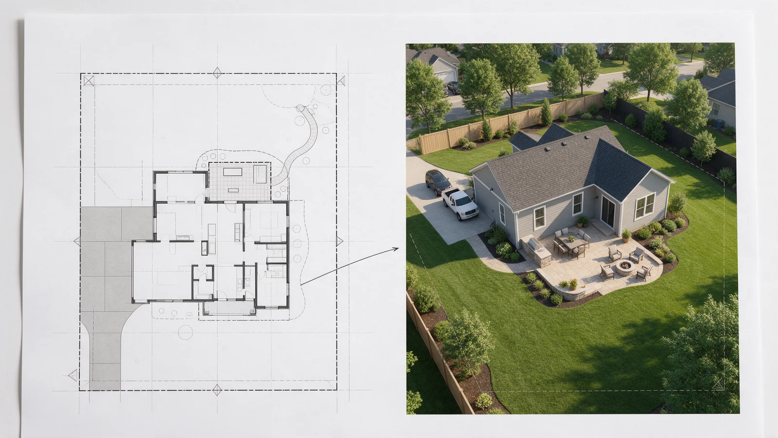
Need to show how your project changes ground levels or where stormwater will go? We help scope and coordinate the appropriate grading and drainage documentation.

Nationwide serviceProject-specific scopePDF deliverables
Grading & Drainage Plans for Site Development & Permits permit drawing service
Grading & Drainage Plans • Make A Site Plan

What Is This Service?

Grading & Drainage Plans, explained clearly

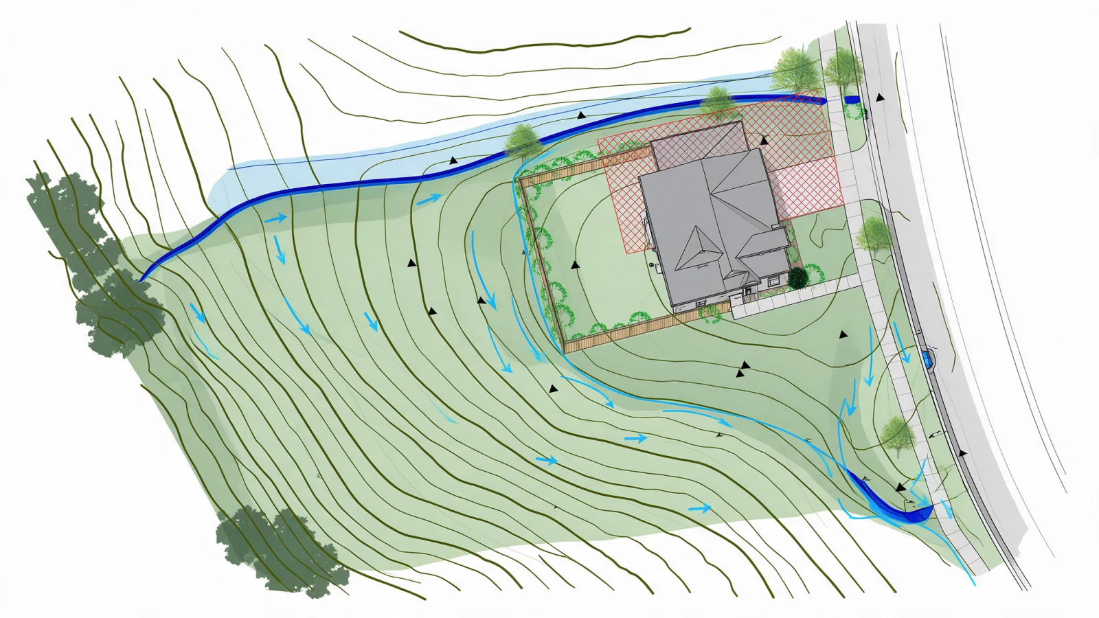
Grading plans illustrate existing and proposed ground elevations; drainage plans explain intended runoff routes and applicable stormwater features. The design may require surveying, hydrologic analysis or a locally licensed civil engineer depending on the jurisdiction and site.

Who Is This Service For?

  • Owners building on a sloped or flood-sensitive site
  • Contractors constructing driveways, pads, additions or new buildings
  • Applicants responding to drainage, erosion or finished-floor elevation comments

Common Project Challenges

Common Problems We Help Solve

01

The reviewer asks how runoff will avoid neighboring lots or structures.

02

Proposed grades or finished-floor elevations are missing.

03

Driveway, retaining-wall or site changes affect drainage pathways.

Project ReviewHave a similar requirement? Send us your project information.
Request a Project Review

Included Scope

What Can Be Included?

The exact scope is tailored to your project and confirmed in your written quotation. Depending on the requirements, the work may include:

  • Existing and proposed spot grades or contours, when valid topography is supplied
  • Direction-of-flow arrows, swales and drainage paths
  • Finished-floor, pad and driveway elevations as applicable
  • Relevant stormwater features and drainage structures
  • Impervious surface information and site area tables
  • Erosion/sediment control or cut/fill information when specifically scoped

Permit Review Context

What matters when scoping Grading & Drainage Plans

Grading and drainage drawings become important when a project changes ground elevations, adds impervious area, alters runoff paths or requires erosion-control information. The required level of detail depends on the site, local stormwater rules and the amount of land disturbance.

We use these topics to frame the drawing scope, but the final submittal requirements are set by the city, county or other reviewing authority for the project address.

01existing and proposed grades
02drainage direction and runoff
03spot elevations and contours
04erosion and sediment control
05limits of disturbance
06finished floor elevation
07swales and drainage paths
08retaining wall and slope coordination

What You Receive

  • Grading or drainage plan sheets appropriate to the contracted level of design
  • Defined assumptions and required source survey/topography
  • Supporting notes and details within the agreed scope
  • Engineering review/calculations only when specifically included

Projects We Commonly Support

  • New home sites and building pads
  • Driveways and slope changes
  • Additions with changed drainage
  • Commercial grading and site improvements
Drawing ScopeUnsure which drawings apply? We can review the available documents and define the scope.
Ask About Required Drawings

From Intake to Deliverables

How the Process Works

  1. 01

    Share the property and project

    Send the address, proposed scope, available files and reviewer comments.

  2. 02

    We assess the drawing needs

    We identify missing information and agree on the proposed scope, deliverables and quotation.

  3. 03

    We prepare and coordinate

    The contracted documentation is prepared using the inputs and relevant project requirements.

  4. 04

    Review and receive files

    You check the drawings; agreed corrections and final deliverables follow the written scope.

Why Make A Site Plan

Why Work With Make A Site Plan?

  • Scope is matched to actual city/county comments and site constraints.
  • We distinguish drafting from engineered drainage design rather than promising both under one basic fee.
  • Coordination can extend to site planning and structural retaining-wall documentation.

What We Need to Get Started

  • Survey with topography and benchmarks when needed
  • Property location, existing drainage observations and photos
  • Proposed layout, finished floor target and driveway location
  • Relevant city comments, civil requirements or drainage reports

Explore the Right Path

Related projects, guides and locations

Use these pages to understand the project type, prepare the right property information and see how permit requirements vary by location.

Frequently Asked Questions

Questions About Grading & Drainage Plans

Can you design drainage from an aerial image alone?

An aerial image is generally insufficient for engineered elevations or drainage calculations. Reliable topographic and other site data may be required.

Will the package include stormwater calculations?

Only if explicitly included after assessment of the jurisdiction and site requirements.

Can you show finished-floor elevation?

Yes, where appropriate survey benchmarks and engineering inputs support the elevation shown.

Do these drawings require a PE seal?

Some jurisdictions or project scopes do. Any seal is subject to the licensed professional’s independent review and acceptance.

How do I know exactly which drawings my permit office requires?

Send the property address and a short description of the proposed work. We use the jurisdiction and project type to define the likely drawing scope before drafting begins. Final submittal requirements remain subject to the reviewing authority.

Can I send an existing survey, sketch, photos or permit comments?

Yes. Existing surveys, recorded plats, sketches, photos, prior plans and correction comments can all help establish the drawing scope and reduce avoidable assumptions.

Do you work with projects nationwide?

Yes. Make A Site Plan supports projects across the United States. Because permit procedures vary by city and county, we check the project location before finalizing the scope.

Can you guarantee that the permit will be approved without comments?

No. Approval is controlled by the reviewing jurisdiction. Our process is designed to make the drawings clear, coordinated and responsive to the known submittal requirements, and we support in-scope permit comments when they occur.

Ready to Get Started?

Grading & Drainage Plans for Site Development & Permits

Send your property information and available drawings. We will review the requested work, identify important missing details and provide a defined scope and quote before production begins.

Prefer to talk?+1 (385) 885-5362

Professional notice: Requirements vary by jurisdiction. Services requiring professional licensure are undertaken or reviewed by appropriately licensed professionals where applicable and subject to independent review and acceptance. Permit approval rests with the responsible authority.

Request a Grading & Drainage Review

Tell us about your project and attach any survey, plans, photos or permit comments you already have.

Enter your name.

Enter a valid email address.

Enter a valid phone number.

Enter the property address.

Select a project type.

Tell us briefly about the project.

Survey, sketches, photos, old plans or city comments. PDF, JPG, PNG, DWG or DXF. Up to 5 files, 15 MB each.

Up to 5 files, 15 MB each.

By sending this form you agree to our Privacy Policy. No spam, ever.

CallWhatsAppGet a Quote